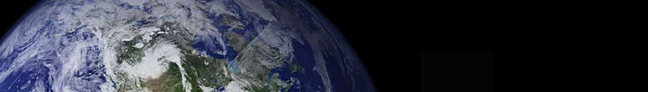
There are a number of reasons to prefer satellite data over surface data for temperature measurement –satellites have better coverage and are not subject to site location biases. On the flip side, satellites only have limited history (back to 1979) so it is of limited utility for long-term analyses. Also,they do not strictly measure the surface, but the lower troposphere (though most climate models expect these to move in tandem). And since some of the technologies are newer, we don’t fully understand biases or errors that may be in the measurement system (though satellites are not any newer than certain surface temperature measurement devices that are suspected of biases). In particular, sattelites are subject to some orbital drift and changes in altitude and sensor function over time that must be corrected, perhaps imperfectly to date.
To this latter point, what one would want to see is an open dialog, with a closed loop between folks finding potential problems (like this one) and folks fixing or correcting the problems. In the case of both the UAH and RSS teams, both have been very responsive to outside criticism of their methodologies, and have improved them over time. This stands in stark contrast to the GISS and other surface temperature teams, who resist criticism intensely, put few resources into quality control (Hansen says a quarter man year at the GISS) and who refuse to credit outsiders even when changes are made under external presure.
I thought it was Gavin Schmidt after the Russian debacle last fall who said that they only had a quarter man year for quality control. If I recall correctly, he said that it would cost 500 grand to program to avoid the same problem in the future. A commenter at Climate Audit posted two lines of code that he said would do the job and wrote that GISS was free to use it.
“A commenter at Climate Audit posted two lines of code that he said would do the job and wrote that GISS was free to use it.”
Oh, great. Now they have to spend two man-years to check the code.
In re: QA/QC at GISS-
Why waste precious resources on QA/QC when the science is settled?
AGW is perfect. It is divinely inspired by Gaia, and is error free, complete in every way.
It looks like you are ignorant of the extreme difficulty of measuring the bottom of the atmosphere from a position outside the top of it, compared with the ease of measuring the bottom of the atmosphere from within it.
It also looks like you’re entirely unaware of the close agreement between satellite and surface temperature records.
Back when I did my reports on the subject of ‘global warming’ (waaaay back before most of you had even heard the term in the late 80’s/early 90’s) the professors I chased down at MIT and Boston College (that were quoted in the Newsweek article that first introduced the concepts to the mainstream), they pointed me to a number of similar arguments.
The two that come to mind related to the ‘blacktop’ effect on weather station reporting (higher ground temperatures in the immediate vicinity of urban weather stations that were only at or immediately near ground level due to urban development) and problems with ocean surface temperature measuring methods. The latter related to a specific change that took place about the time those reports started to show minute increases.
Specifically, ocean surface temperatures have always been taken by maritime observers as a normal function of keeping a ship’s log. Prior to demonstrated increases, the standard method was to lower a treated canvas or burlap bag into the water, raising it to the bow of the ship and taking a measurement. After the introduction of poly-synthetics, plastic buckets were used instead.
One of the professors I spoke with actually did some of his own tests with the two methods based on a hypothesis that the cloth sacks, when wet on the outside, would be subject to evaporation and would be less insulated than the plastic buckets. The results from his tests and raising such a bag the approximate average height of a ships bow reflected almost identical ‘drops’ of a fraction of a degree using the old method.
Incidentally, at that time the biggest indicators of ‘proof’ of global warming constituted a fraction of a degree increase in both urban weather stations and ocean surface temperatures.
Incidentally, one of the largest portions of the first of the reports actually focused on causes of ‘global cooling’ which I was pointed to by the first of the two professors (the one from MIT). He told me to look into the four primary sources of cooling, mainly: water, water, water and water. He also then directed me to look into the greatest influence on reducing greenhouses gases. (also related to water)
Sources of global cooling:
1) the greatest influence on keeping earth’s temperature down is the thing that covers 2/3rds of the surface of the planet. The reflect surface of the world’s oceans reflects a large quantity of the Sun’s energy (the greatest cause of global ‘warming’) back into space before it can heat the planet and/or be radiated in a form that can be ‘trapped’ by the gases in the atmosphere.
2) similar to the oceans, the white tops of clouds (water vapor) also reflect sunlight harmlessly into space producing the same result.
3) similar to the oceans and clouds, the white polar ice caps (frozen water) not only reflect light back into space but due to their positions on the globe also ‘refract’ a large portion harmlessly off the other side of the atmosphere in the same fashion.
4) due to the ocean surfaces, the clouds and precipitation, water wherever it can be found on the surfaces of the earth will evaporate when introduced to the heat energy released when solar light is converted into heat. The resulting evaporation uses up some of that heat energy further cooling the surface of the earth.
And as for greenhouse gases, we all of course know that plants turn various carbon molecules (and in some cases even methane and other greenhouse gases) back into other useful compounds and gases such as oxygen and carbohydrates. But alas, only 1/3 of the planet is covered by land right? Not to worry, because anywhere and everywhere that the earth is covered by water, the top 2-3 inches of that water (more depth and density when temperatures are higher) are covered with small green plants! Yes, the vast majority of photosynthesis takes place not in trees and grasses, but in the surfaces of the world’s oceans!
If you think about it and if they ‘are’ right about both the causes and the effects (melting ice caps, raising sea levels – e.g. increased ocean surface worldwide, increased surface temperatures on land and at sea and erratic excesses in weather) then the results may well be an eventual drastic swing the other day as we see increases in reflection, evaporation and conversion of ‘greenhouse’ gases back into inert forms!
Yet another reason to trust satellites is that weather balloons agree with them.
“It also looks like you’re entirely unaware of the close agreement between satellite and surface temperature records.”
Right, that’s why the National Academy of Sciences spend so much time and money doing reports discussing why there is so much divergence:
http://www.nap.edu/catalog.php?record_id=9755#toc
They must have nothing better to do with their time…
As for what the real differences are (as opposed to just making vague disparaging comments)), see here:
http://www.woodfortrees.org/plot/gistemp/from:1979/to:2010/trend/plot/gistemp/from:1979/to:2010/plot/rss/from:1979/to:2010/plot/rss/from:1979/to:2010
Has anyone been watching the NPOESS project? It’s the new National Polar-orbiting Operational Satellite Systems project. We should be launching our first satellite in January 2011 with 3 more to follow. We’re way late in the launch, minor detail. One of the items the satellites will be carrying is the CrIS sensor, the Cross-track Infrared Sounder. Talk about a leap of technology. Multilayered atmospheric temperature measurement across the earth with resolutions never before seen.
It will be nice to get these guys up and watch the debate that ensues.
More info for those of you interested can be found at
http://www.ipo.noaa.gov/index.php
Cheers.
Richard H.
Crud. Can’t even get the acronym right. It should be
National Polar-orbiting Operational Environmental Satellite System.
or NPOESS for short.
Richard H.